

 Log in om de coördinaten te kunnen zien.
 89x Gevonden
  0x Niet gevonden
  0 Opmerkingen
  3 Volgers
  Beoordeeld als: uitstekend
 35 x Aanbevolen


 Cache attributen


 Beschrijving
 |
Do Not Look Down! |
Góry Stołowe (the Table Mountains) - a land born of the sea, millions of years ago... is one of the most beautiful and attractive mountain ranges in Poland, a unique place due to its terrain, beautiful rock formations, unique “rock cities”, labyrinths and peculiar forms called rock fungi. Outstanding natural and landscape values are reasons that the National Park of the Table Mountains has been established here in 1993.
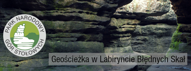
Labirynt Błędnych Skał - The Maze of Errant Rocks is located on the north-western edge of Skalniak. It covers a complex of peculiar rock formations with a height of 6 - 11 m, created as a result of weathering sandstone. Errant Rocks is a maze of crevices and alleys, sometimes extremely narrow, separating rock blocks of several meters in height. Many rocks have their own names, for example: “ The Rock Saddle”, “The Hen’s Leg”, “The Tunnel” and “The Grand Hall”. The only observation deck on the route is “The Rock Skuls”. The Szczeliniec Wielki and Mały, city of Machov, and in good visibility, The Karkonosze mountains can be seen from here. Difficult weather conditions, which usually prevail here, cause that the majority of spruces have broken crowns, and other tree species, such as pine and birch, take fanciful, bent shapes. This is a unique place - visit, enjoy the mountains, collect caches; but do not destroy, do not litter - let's preserve this beauty for the next generations.
|
|
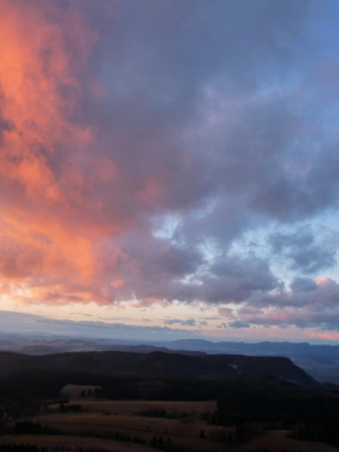
We kindly invite you to a place that bursts at the seams during the day from the flood of people who want to visit the Errant Rocks. However, at night there is no more beautiful position to admire the surrounding villages from the viewpoint, and if we look up then .....! Just not looking down makes our riddle impossible to solve! Fire up your UV flashlight and get going! After sunset, in a cloudless sky you will feel a tiny part of the Milky Way, move into distant galaxies and into the world of myths and legends hidden in the sky. How to get to Errant Rocks by night? We recommend you park your car in the YMCA car park, then head to the top of the blue or green trail. The above trails are also geotrails that are worth visiting. We recommend that you enter the unusually charming blue trail and descend green. If you travel by bike, you can take the asphalt road to the top. Note: If you want to enter the last car entry, ask the service about which the lower entry is closed. For security reasons, the gate is closed at night. Leaving the car after an hour of the last exit will result in leaving the car until the morning in the upper parking lot which is inconsistent with the regulations. That is why we suggest walking before dark or entering by bicycle. |
|
At the top there is the possibility of using the infrastructure for tourists. The barbecue and bonfire site prepared for the tourists' use. The only condition for using these points is to leave order. If you would like to take advantage of the possibility of lighting a fire, we recommend that you download the prepared wood next to the yellow building. Remember to put out the fire you lit! Do not cause danger by leaving a bonfire without control! We invite you to play. Armed with a UV flashlight, go to the places indicated in the waypoints. The number of letters in Latin names is your data, which just need to be put into the formula:
N 50 28.(F)(A-3)(E) E 016 17.(C-2)(B-1)(D-E) |
|

About the cache: The cache is hidden along the tourist trail! It is NOT possible to reach this cache from a different direction but from the trail. There are a selection of various gadgets, You can choose something for yourself - add something from yourself - next cacher would like to find something cool, too !!!
Act carefully so that you take no risks. You do not have to go on rocks or climb anything! Take care of passers-by so as not to disclose the cache location to Mugglers. Finally, put it back, in exactly the same place, please. "Invisibility" at the highest level!
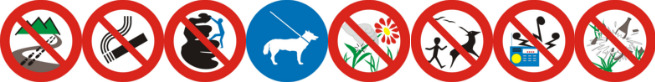
The all of nature, specific landscape features and national heritage objects are protected in the area of the National Park. The task of the National Park is not only to protect this particular landscape, but also to make it available for visitors. However, you neet to remember about certain rules:
|
|
|
 OpenChecker
 Extra waypoints
| WP nummer | Symbool | Soort | Coördinaten | Beschrijving |
|---|---|---|---|---|

|
Interessante plek | --- | Punkt widokowy / View point. Tu możesz patrzeć w dół. / You can look down from here. | |

|
Parkeerplaats | --- | Parking. | |
| 1 |

|
Fysiek punt | --- | Stage 2. AB |
| 2 |
|
Fysiek punt | --- | Stage 3. CD |
| 3 |
|
Fysiek punt | --- | Stage 4. EF |
| 5 |

|
Eindlocatie | --- | Final Location (Lokalizacja finałowa) |
 Extra hints
 Afbeeldingen

 Logs:
89x
0x
0x
Logs:
89x
0x
0x


