

 Please log in to see the coordinates.
 159x Found
  0x Not found
  0 notes
  1 watchers
  Rated as: Excellent
 8 x recommended


 Cache attributes


 Description
 |
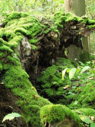
The story of a fallen tree. |
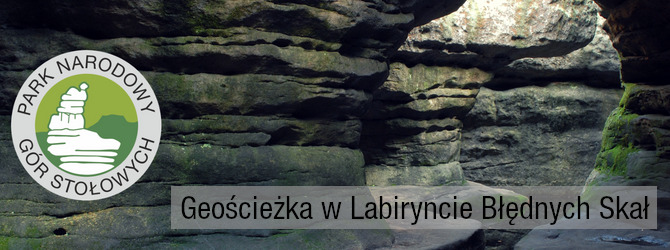
Góry Stołowe (the Table Mountains) - a land born of the sea, millions of years ago... is one of the most beautiful and attractive mountain ranges in Poland, a unique place due to its terrain, beautiful rock formations, unique “rock cities”, labyrinths and peculiar forms called rock fungi. Outstanding natural and landscape values are reasons that the National Park of the Table Mountains has been established here in 1993.
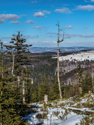
Labirynt Błędnych Skał - The Maze of Errant Rocks is located on the north-western edge of Skalniak. It covers a complex of peculiar rock formations with a height of 6 - 11 m, created as a result of weathering sandstone. Errant Rocks is a maze of crevices and alleys, sometimes extremely narrow, separating rock blocks of several meters in height. Many rocks have their own names, for example: “ The Rock Saddle”, “The Hen’s Leg”, “The Tunnel” and “The Grand Hall”. The only observation deck on the route is “The Rock Skuls”. The Szczeliniec Wielki and Mały, city of Machov, and in good visibility, The Karkonosze mountains can be seen from here. Difficult weather conditions, which usually prevail here, cause that the majority of spruces have broken crowns, and other tree species, such as pine and birch, take fanciful, bent shapes. This is a unique place - visit, enjoy the mountains, collect caches; but do not destroy, do not litter - let's preserve this beauty for the next generations.
|
|
In the past, almost the entire surface of Skalniak's top was covered with a set of peat bogs, of which only The Long and Round Bog (Długie i Kragłe Mokradło) were left. All thanks to the drainage that was carried out in the 19th century, so that the local water conditions would be more favorable to forest cultivation. The Skalniak top has been cut with dozens of kilometers of drainage ditches, which gradually drained the area. The lower availability of water led to peat moss drying and the disappearance of wetland vegetation. In its place, the monoculture of Norway spruce, so-called artificial Sudeten spruce forest, was introduced in the entire Sudetenland. Unfortunately, the spruce was of foreign origin. Therefore, it did not have features that would allow survival in foreign conditions. With the lowering of groundwater, trees were weakened. The weakened trees became a tasty morsel for the bark beetle. Dead trees were partially removed from the area, but the greater part of the living and dead trees remained. |

|
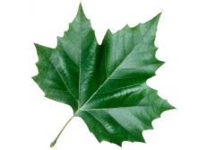
The fallen trees we can see are evidence that spruce is not a naturally occurring species in the area. The spruce is one of the few species of trees that has a disk root system. When you look at the fallen tree, you will not find the main root in the carps, which could keep the tree up and protect it from falling. The image of the forest you witness here is the best proof that nature should not be regulated. |
|

About the cache: The cache is hidden along the tourist trail! It is NOT possible to reach this cache from a different direction but from the trail.
Act carefully so that you take no risks. You do not have to go on rocks or climb anything! Take care of passers-by so as not to disclose the cache location to Mugglers. Finally, put it back, in exactly the same place, please. "Invisibility" at the highest level!
The all of nature, specific landscape features and national heritage objects are protected in the area of the National Park. The task of the National Park is not only to protect this particular landscape, but also to make it available for visitors. However, you neet to remember about certain rules:
|
|
|
 Additional waypoints
| Symbol | Type | Coordinates | Description |
|---|---|---|---|

|
Parking area | --- | Parking YMCA. Parking bezpłatny / Free parking / Parkování zdarma / Kostenlose Parkplätze. |
|
|
Parking area | --- | Parking płatny. Opłata za wjazd na parking górny wynosi 20 zł za samochód osobowy, 10 zł za motocykl płatna przy wjeździe na drogę dojazdową. |

|
Trailhead | --- | Wjazd / Road access / Vstup / Eintrag. Punkt opłat wjazdowych / The fee for entry to the upper car park is 20 PLN for a passenger car, 10 PLN for a motorcycle payable at the entrance to the access road / Poplatek za vstup do horního parkoviště činí 20 PLN za osobní automobil, 10 PLN za motocykl splatný při vjezdu do příjezdové silnice / Die Gebühr für den Eintritt in den oberen Parkplatz beträgt 20 PLN für einen PKW, 10 PLN für ein Motorrad am Eingang zur Zufahrtsstraße. |
 Additional hints
 Pictures
 Log entries:
159x
0x
0x
Log entries:
159x
0x
0x


